
Taking a look at the maps in my cupboard.....
Bartholemew (UK)
John Bartholomew & Son, Edinburgh, Scotland
When it comes to mapping in the United Kingdom the only real rival to the Ordnance survey was Bartholomew'
Bartholomews began printing maps of Scotland in half inch scale in 1875 followed by maps of England and Wales in 1897. A later series combining the whole of Britain was completed by 1936.
Bartholemew was at the height of popularity in the early part of the twentieth century when his cycling and touring maps were flying off the shelves. The half inch scale was very popular with both the general public and the military.
Always considered the poor relation to Ordnance survey, Bartholemew would continue to make maps into the new millenium but would never be as popular again.
Late in the 1980s bartholemew would be absorbed into the giant publisher Harper-Collins and is these days known as Collins-Bartholemew.
The maps that Bartholemew made were different to those of the Ornance survey. Some of the differences were good, some were bad. Anyone comparing maps of the same place and of the same era would immediately notice a difference in terrain colour, amount of legend information in the borders and a colour differential between railway lines and roads. The latter being a real downside on Bartholemews part.
Where Batholemew really stood out was the fantastic use of colour. Shades of greens, blues and browns that offered a wonderfully vivid look at the landscape. Certainly less dull than the OS equivelent of that tme.
Bartholemews maps are not considered that valuable on the collectors market at the moment. Currently a decent quality linen backed map can be bought for as little as three pounds each. Maps were available on standard and cloth backed paper with the cloth version appearing to fair better with wear and tear over time. Paper versions then are best avoided unless in mint condition. Despite their age, the coloured inks used in manufacture dont seem to fade over time which can only be a plus point.


By the 1930s the maps seem to have undergone a face lift of sorts with the addition of an all blue front and rear cover, different type face and a royal patronage from King George V amongst others.
The price of this map was 3 shillings for cloth backed and 2 shillings for paper which was a slight increase from the earlier series.
The design is certainly of the period and arguably more appealing than earlier versions.
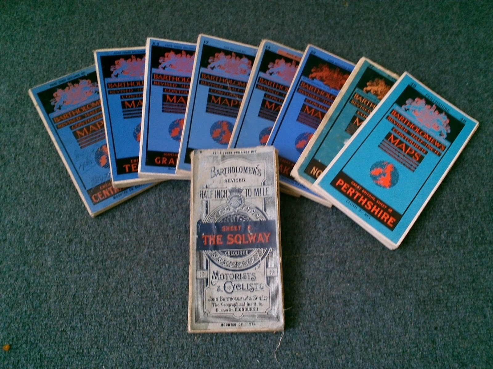
The three 1930s 'blue series' in the photo above cover central Wales, Teesdale in Yorkshire and the Grampian region of Scotland respectively. All are cloth backed maps in good to very good condition. Likely to be worth up to seven pounds each on average. As these maps become more rare the value should appreciate.

These 1940s 'blue series' were virtually identical in appearance to the preceeding one
with only a change of wording, change of crest colour and a further price increase from 3 shillings to 4 shillings for cloth backed and from 2 shillings to 3 shillings for paper were the only real changes. Of course any road or rail updates were added.
In the collection are currently the Peak district, Herfordshire & Buckinghamshire and Cardigan as shown in the above photo. All are in good condition except a couple of scuffs here and there. Probably worth up to eight pounds each in the current climate.
The passing of the royal patron
One less obvious but major change to the look of the maps came sometime after the death of King George V in 1936.All blue series maps carried the slogan "Cartographers by appointment to the King' beneath the royal coat of arms, that slogan would later read 'By appointment to the late King George V' and so this new wording would remain on the covers for years afterwards - even after the next two monarchs came and went. The reason for this is because king George was the only royal to appoint Bartholemew and subsequent royals didn't wish to patronise Bartholemew themselves.


Here are a couple of photos showing the interesting colour scheme that Bartholomew used. The photos don't really do the maps justice.

More from Bartholemew
Pharmaceutical Company Promotions

Sometime either in the 1960s or 1970s a company called Dulpha commisioned Bartholomew to knock them up a few lightweight promotional maps presumably to be given away free in doctors surgeries or chemist shops. The maps featured 'main routes and specific areas' according to the wording which basically means they are reprints of the half inch maps. Unfortunately little else is known about these two 'limited edition' series.

What is the difference between the shitty brown series and the blood red series? - A prime example of the gap in the research with these maps. On the face of it the maps appear to be exactly the same and so it's the product advertised that is different and nothing else.

Trust the bowel relief drug to be on brown paper!
The products featured here for promotion appear to be a laxative type drug on the brown coloured map called Duphalac and an IBS (irritable bowel syndrome) drug called Colofac on the red coloured map.
Research suggests that both products are still in production and using the same names.
Research suggests that both products are still in production and using the same names.

The photo above shows one of the promo Cardigan map unfolded. It is obvious that it's a bartholomews map.
These freeby maps would have been useful to collect back in 60s or 70s as it would save you a few shillings having to buy the regular Bartholomew paper maps.
In terms of worth these maps are difficult to put a price on. They are almost certainly in limited numbers compared to regular maps of the time so their true value may have not been realised yet? Who knows?